Australian activity route planner
Scarborough, Perth and Sydney activities: plan a workable day
Start with the place behind the trip: this guide gives Scarborough a practical beach-and-foreshore plan, then compares specific Sydney activity shapes.
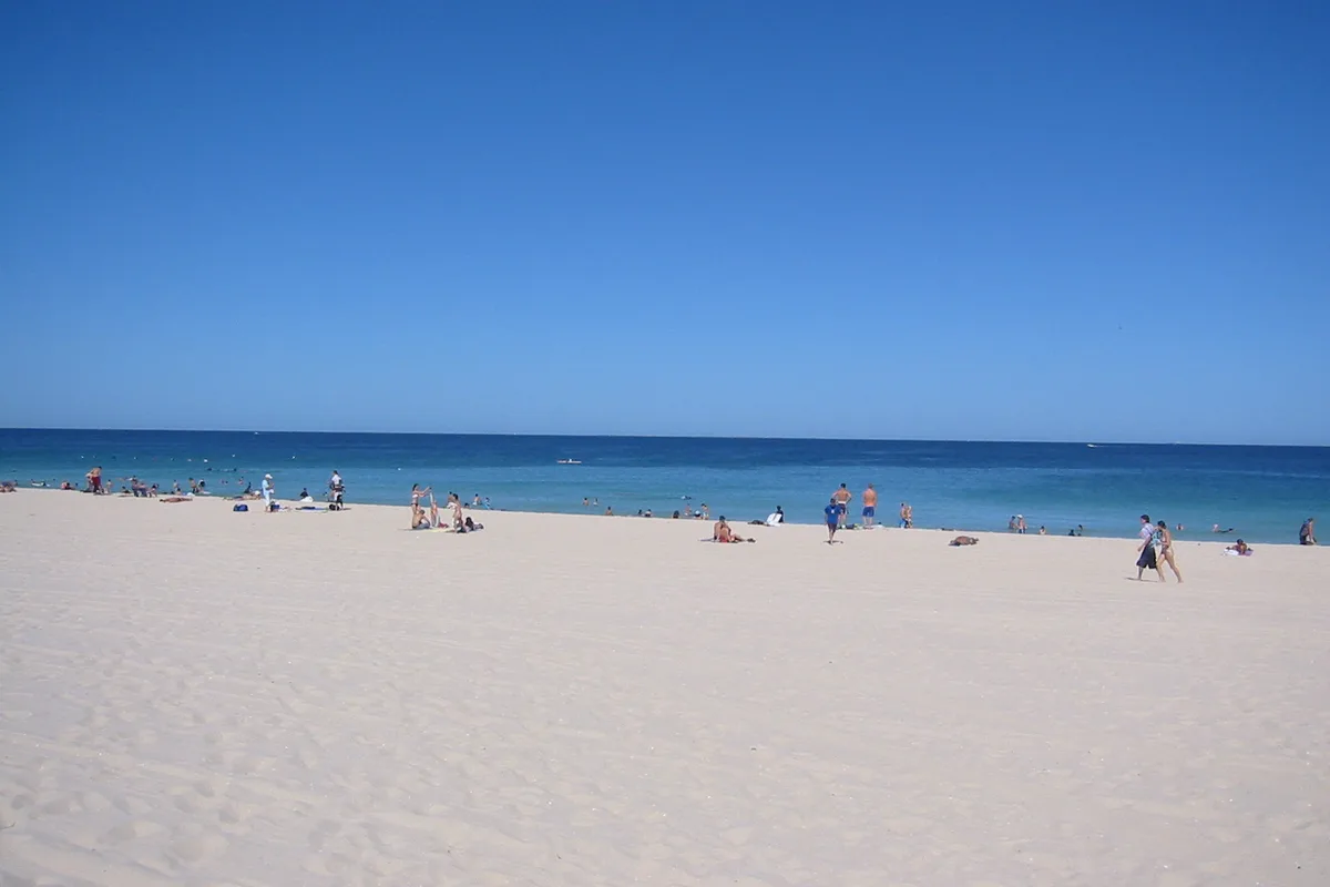

The fastest way to improve an activity plan is to stop asking for a country-wide top ten. Start with the destination behind the journey. Scarborough is an Indian Ocean beach and public foreshore west of central Perth; Sydney’s detailed guides cover a separate east-coast city. Each needs its own transport, weather and access checks.
Scarborough: choose beach, foreshore or a booked activity
The City of Stirling’s current Explore Scarborough Beach guide separates several useful reasons to visit: the foreshore and sunset, the Whale Playground and family play trail, public art, the pool, events and surf lessons. These are not one bundled product.
| Scarborough plan | What it requires | Live check |
|---|---|---|
| Foreshore and sunset | Flexible walking time and a return after dark | City of Stirling alerts and Transperth JourneyPlanner |
| Beach swim | Patrolled-area and hazard decision for that day | Beachsafe and signs on arrival |
| Learn-to-surf session | Named instructor, meeting point, age/skill rules and weather policy | Current operator linked through the City guide |
| Family foreshore | Play trail, toilets, shade and an agreed meeting point | City guide and foreshore map |
| Pool visit | Separate admission and operating information | Current pool page linked by the City guide |
| Event or market | Dated venue, season and finish time | Current City of Stirling event listing |
For a surf lesson, the council’s guide currently points visitors to named local schools. Follow that link to the operator’s dated session; do not assume lesson times, swimming ability rules or equipment from a general beach description.
Getting there without inventing a permanent timetable
Use the Transperth JourneyPlanner with the real origin, arrival deadline and return time. Its advanced options can reduce maximum walking distance or connections. The City of Stirling page describes the current public-transport connection from Stirling Station, but routes and frequency can change—let the dated journey result settle the plan.
Save both the outbound stop and the return stop. A beach sunset creates a different transport problem from a daytime arrival, and an unplanned delay should not leave the group guessing on The Esplanade.
Access needs include the sand, not only the promenade
The paved foreshore and the beach are different environments. The City of Stirling’s access and inclusion initiatives provides current information on facilities such as Changing Places and beach wheelchairs. Confirm availability, collection procedures and conditions directly before travel; equipment access is not guaranteed by simply arriving at the sand.
Compare real Sydney day shapes
| Day shape | Fixed commitment | Flexible additions | Main risk to check |
|---|---|---|---|
| Harbour architecture | Opera House tour | Bennelong Point, gardens or one ferry | Correct meeting point and stair demand |
| High physical commitment | Harbour Bridge climb | The Rocks and Dawes Point | Eligibility, weather and personal-item rules |
| Evening history | Rocks ghost walk | Daylight museum context and Circular Quay | Hills, stairs, rain and late return |
| Family rides | Luna Park | Ferry crossing or north-shore foreshore | Dated ride operation and height rules |
| Wildlife day | Featherdale | Keeper schedule and unstructured viewing | Blacktown-to-bus-729 connection |
| Coast on foot | Bondi to Coogee walk | Swim only when conditions and patrol advice suit | Sun, exposure, stairs and the return route |
| Mountain region | Blue Mountains day trip | One lookout cluster or a verified attraction | Park alerts, visibility and local transport |
| Time on the water | Harbour tour comparison | A destination at the ferry landing | Exact wharf, vessel and weather policy |
Use Destination NSW’s current Sydney tour directory to discover named operators. Then open the operator’s own product for the dated departure, meeting point, access requirements and cancellation terms.
Choose by commitment, not by popularity
Low commitment: a public ferry, self-guided neighbourhood walk, garden or beach view can change with weather and energy. It still needs a return plan, but it does not dominate the diary.
Medium commitment: a museum, building tour or wildlife park fixes an admission window or substantial travel block. Add only nearby flexible activities.
High commitment: BridgeClimb, an open-water boat, a long coastal hike or a Blue Mountains circuit adds physical, weather or cancellation consequences. Protect the hours around it.
Ratings do not answer these questions. A popular activity can still be wrong for a guest who needs a step-free route, cannot use ladders, gets motion sickness or has only a short transfer window.
Sydney’s four useful planning zones
Harbour core
Circular Quay connects the Opera House, The Rocks, ferries and the southern bridge approach. Choose the exact wharf or meeting point; “Circular Quay” contains several. A bridge climb and an Opera House tour can each anchor the same broad area, but combining both as tight bookings leaves little resilience.
Central city
The QVB, Hyde Park, Australian Museum and Market Street theatre area suit a compact city day. They are also useful wet-weather choices, though walking between them still involves outdoor streets. Use the Market Street planner for a mapped version.
Eastern coast
Bondi Junction is an inland interchange; Bondi Beach requires the final bus or road leg. Coastal walking adds stairs, exposure and a return from a different suburb. Check Beachsafe for current patrol and hazard information before swimming.
Western Sydney and beyond
Featherdale uses a western train plus bus 729. The Blue Mountains continue much farther and require their own local plan. Their shared compass direction does not make them a single easy independent outing.
When the destination is another Australian city
Start with the current state or territory tourism body rather than transferring Sydney assumptions:
- New South Wales: Sydney and NSW
- Victoria: Visit Victoria
- Queensland: Queensland
- South Australia: South Australia
- Western Australia: Tourism Western Australia
- Tasmania: Discover Tasmania
- Northern Territory: Northern Territory
- Australian Capital Territory: VisitCanberra
Then use the local transport authority and the venue or operator itself. Climate, distances, last services and activity geography differ materially between cities.
Six checks before payment
- Match the operator and activity name across the product and confirmation.
- Save the exact start and finish locations—not just the suburb.
- Read age, health, supervision, mobility and personal-item requirements.
- Check who decides a weather cancellation and how they contact you.
- Review the final total, currency and cancellation window.
- Plan the return after the advertised finish, including a delay margin.
Addresses and meeting points
Put the activity on the map
Use these points for orientation. Your dated ticket or operator confirmation takes priority if it names a different entrance, wharf or meeting point.
Scarborough Beach foreshore
The EsplanadeWA 6019 ScarboroughAustraliaUse the foreshore as the activity anchor, then check beach conditions and the return route separately.
Circular Quay
Alfred StreetNSW 2000 SydneyAustraliaUse the exact wharf, station exit or light-rail stop named by the next activity.